The best beaches in La Paz, Baja California Sur (and how clean the water is)
The most famous are Balandra and El Tecolote, about 25 km from downtown [4], but there are calm beaches minutes from town such as Coromuel, El Caimancito and El Tesoro. In official testing in summer 2026, all 14 La Paz beaches sampled were rated suitable for swimming, with bacteria levels far below the health limit [1] [2].
La Paz has something unusual: calm, clear-water beaches less than half an hour from town. The bay is sheltered from Pacific swell, so at most of them you can swim easily. Here are the best, from closest to farthest.
Is the water clean?
Mexico's health authority (Cofepris) tests seawater before each holiday season. A beach is rated suitable when it has fewer than 200 enterococci per 100 ml, the threshold based on WHO guidelines [2]. In June 2026 testing, all 14 beaches sampled in La Paz were suitable, with values between 10 and 23 [1].
| Beach | Enterococci (MPN/100 ml) | Result |
|---|---|---|
| Malecón (three sites) | 19–23 | Suitable |
| Coromuel | 22 | Suitable |
| La Concha | 21 | Suitable |
| El Caimancito | 15 | Suitable |
| El Tesoro | 12 | Suitable |
| Pichilingue | 11 | Suitable |
| Balandra | 10 | Suitable |
| El Tecolote | 17 | Suitable |
| El Comitán | 10 | Suitable |
Beaches close to town
Coromuel, La Concha and El Caimancito
They're along the road to Pichilingue, a few minutes from downtown, and all three were rated suitable in 2026 [1]. Perfect for an afternoon swim without a long drive.
El Tesoro and Pichilingue
A little farther, near the ferry terminal. Very calm water, and among the lowest bacteria readings in the city (12 and 11) [1].
The must-sees: Balandra and El Tecolote
Balandra
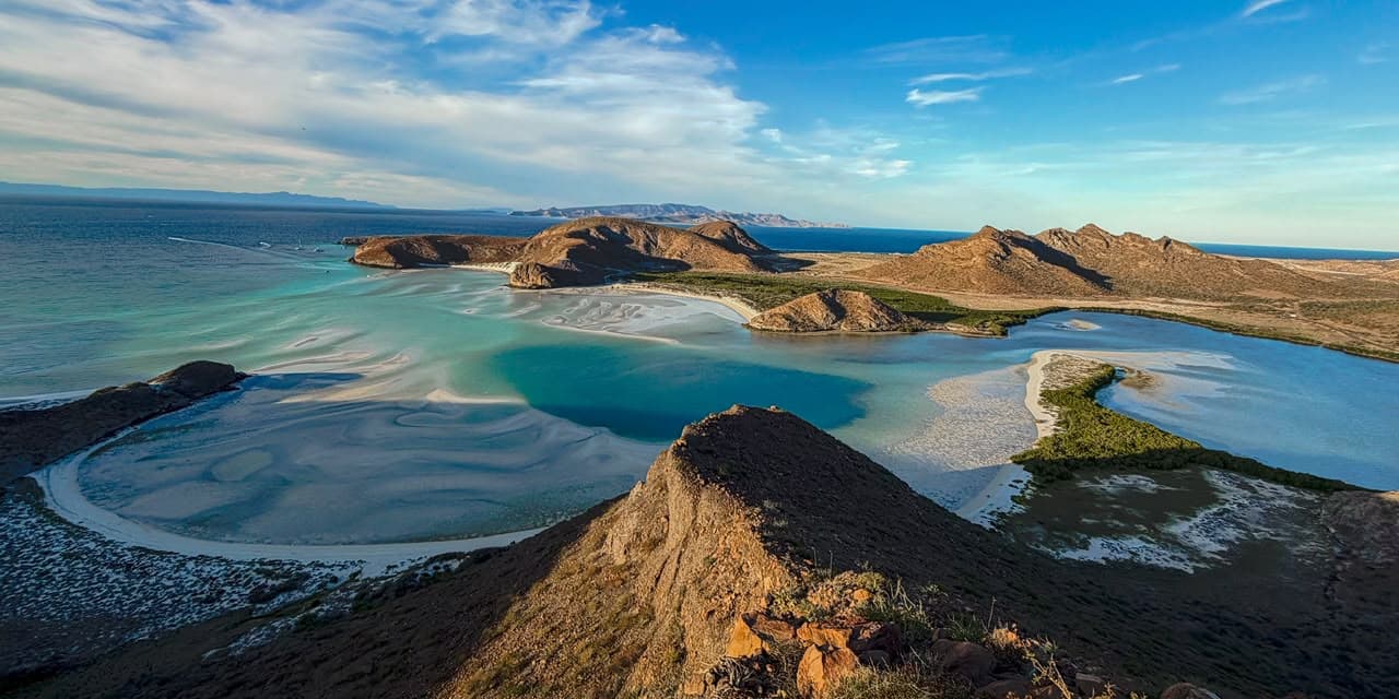
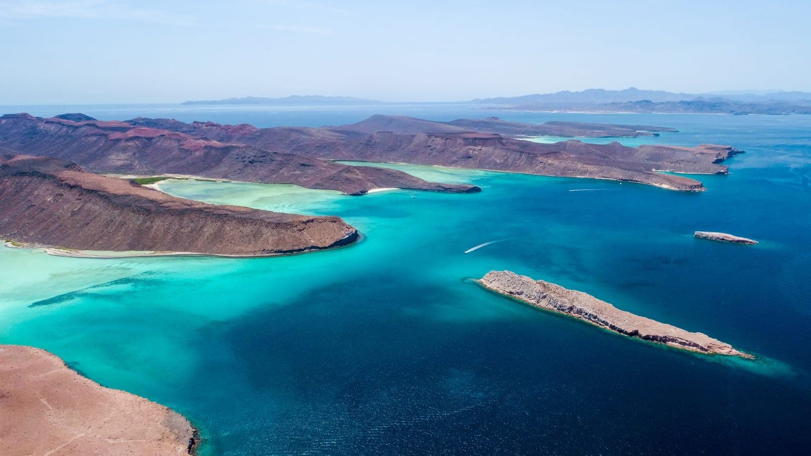
The one in the photos: a turquoise lagoon so shallow you can wade across. It has been a Flora and Fauna Protection Area since November 30, 2012 [3], which is why access is controlled and capped. It's about 24 km from downtown (≈ 30 min) [4]. Everything you need to know is in Balandra Beach guide.
El Tecolote
Just past Balandra (≈ 25 km from downtown) [4]. A long, open beach facing Espíritu Santo Island; check sea conditions before going in.
The ones you can only reach by boat
The most pristine beaches are on Espíritu Santo and Isla Partida: white sand, crystal water and no buildings at all. You can only get there by boat with an authorized operator. On our Espíritu Santo tour we stop at these beaches, see Balandra from the sea and swim with sea lions. Learn more in Espíritu Santo Island guide.
Tips for enjoying the beaches
- Some beaches have no lifeguards. Follow local guidance on whether it's safe to swim [5].
- Wear reef-safe sunscreen: here's why it matters in La Paz.
- Bring water and shade: beaches outside town have few or no services.
- Pack out your trash and don't take shells or sand, especially at Balandra.
Experience it with Keabelmet


Frequently asked questions
What is the most beautiful beach in La Paz?
Balandra is the most famous for its shallow turquoise lagoon; it has been a protected area since 2012 and access is controlled [3].
Are La Paz beaches clean?
In Cofepris testing in June 2026, all 14 La Paz beaches sampled were suitable, with 10 to 23 enterococci per 100 ml against a limit of 200 [1] [2].
Which beach is closest to downtown?
Coromuel, La Concha and El Caimancito are a few minutes from downtown, along the road to Pichilingue.
How do I get to Balandra?
By road, about 24 km from downtown (≈ 30 min) [4], or from the sea on an Espíritu Santo Island tour.
Scientific sources
The wildlife, season and geography facts in this article come from these publications. The [n] citations in the text link here.
- Cofepris (2026). Resultados del monitoreo prevacacional de playas en el estado de Baja California Sur, Verano 2026. Comisión Federal para la Protección contra Riesgos Sanitarios. www.gob.mx/cms/uploads/attachment/file/1088983/Baja_Californ…
- Cofepris (2026). Cofepris confirma que el 98.3 % de las playas mexicanas registran óptimas condiciones sanitarias para el verano. gob.mx/cofepris. www.gob.mx/cofepris/es/articulos/cofepris-confirma-que-el-98…
- Semarnat, Dirección General de Estadística e Información Ambiental (2017). Áreas naturales protegidas federales de México (compendio de estadísticas ambientales): Área de Protección de Flora y Fauna Balandra, decreto del 30 de noviembre de 2012, 2,512.73 ha. Compendio de Estadísticas Ambientales 2017. apps1.semarnat.gob.mx:8443/dgeia/compendio_2017/archivos/01_…
- Colaboradores de OpenStreetMap; cálculo de rutas con OSRM (2026). Distancias y tiempos de manejo estimados desde el centro de La Paz. OpenStreetMap. www.openstreetmap.org/directions?engine=fossgis_osrm_car&rou…
- Foreign, Commonwealth & Development Office (Reino Unido) (2026). Mexico travel advice. GOV.UK (actualizado el 20 de octubre de 2026). www.gov.uk/foreign-travel-advice/mexico